- Claremont-Market-Area 20 Land / Acres $0 to $30000000
- Change Town
-
Narrow your price range.
-
$799,000 | Price Per Acre $0 | Total Lots 22 | Acres 21 NEWPORT NH
View Details & 12 images
Description:Rare Development Opportunity! Approved 22 Lot development sits just outside of Newport, "The Sunshine Town". The seller has met the town's conditions and received approval for 44 duplex units. This exciting opportunity awaits a developer who is ready to start construction! The road infrastructure will be completed to the subgrade. Building areas will be brought to the specified grade per the plans. The soils are all sand, making site work and foundations easy and affordable. The site is within a 30-minute commuting distance of the Dartmouth Hospital and College region. New owners will be attracted to all the new homes in the neighborhood, proximity to town amenities, 10 Minutes to the Mt. Sunapee Ski resort, several restaurants, and medical facilities. Newport is a vibrant community that is a welcoming location for a new development. Owner financing may be considered. Agent Interest.
-
$950,000 | Price Per Acre $0 | Total Lots 22 | Acres 20.7 VILLAGE OF BELLOWS FALLS IN TOWN OF ROCKINGHAM VT
View Details & 37 images
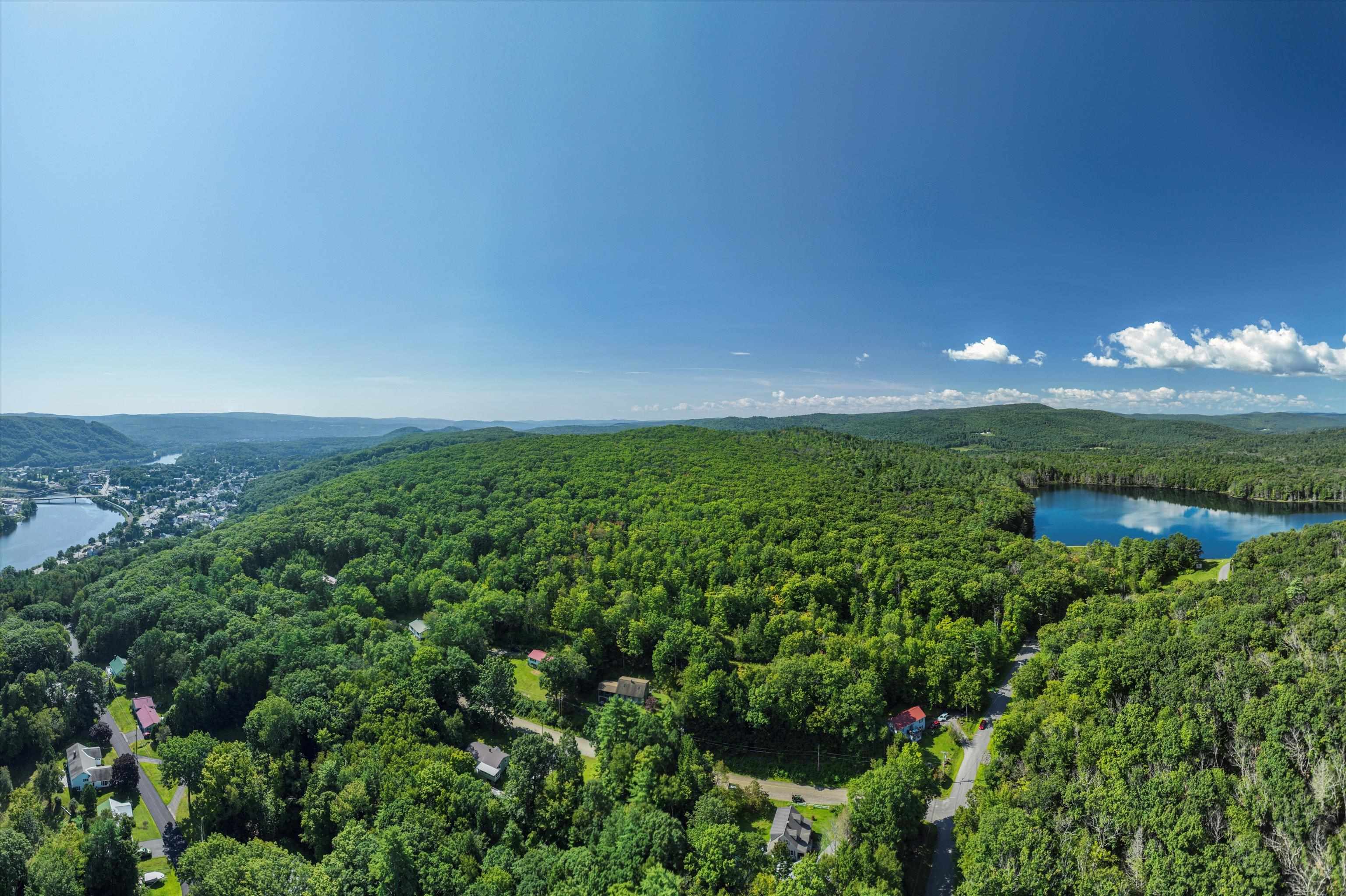
Description:Investors, developers and builders take notice! This large, gently sloped parcel is one the last & largest undeveloped lots of land that fall within the Bellows Falls Village District. Just minutes from downtown and abutting Minard's Pond nature area, this property sits high on the hill with spectacular views available. With dozens of potential building locations and access to town water and sewer at the road, the possibilities are endless! Seller is also willing to entertain selling off smaller parcels, see also MLS #5084134.
-
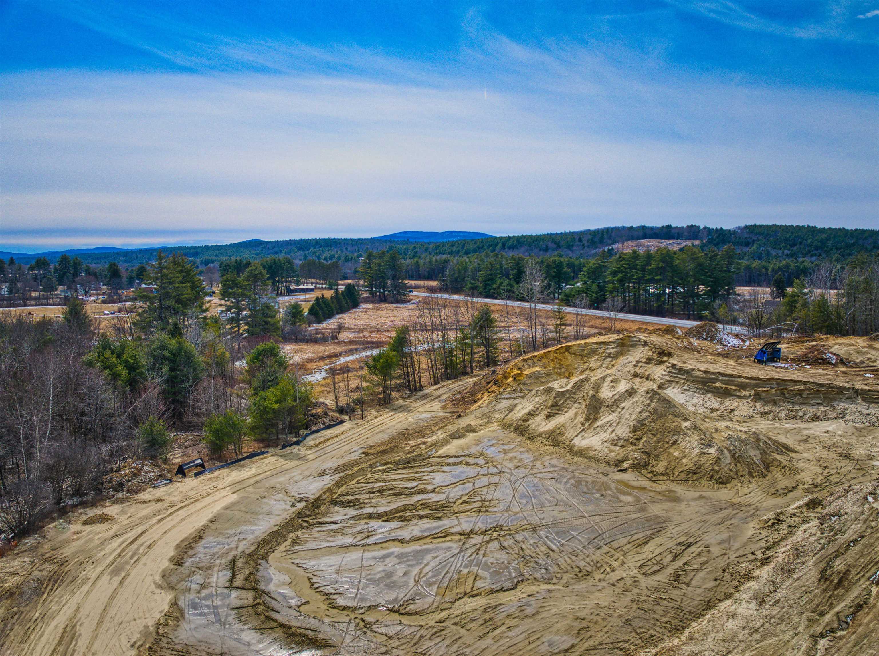
$1,100,000 | Price Per Acre $0 | Total Lots 22 | Acres 60 CLAREMONT NH
View Details & 4 images
Description:Excellent opportunity to own a gravel pit in Claremont with active permits to excavate gravel. This 60 +/- acre parcel offers an abundance of material ready for excavation, making it a valuable investment for those in the construction or landscaping industries. The land, which will need to be subdivided from a larger lot, is well-positioned to meet your gravel supply needs. Don’t miss out on this chance to secure a profitable resource in a prime location.
-
Price Change! reduced by $580,000 down 36% on May 1st 2026
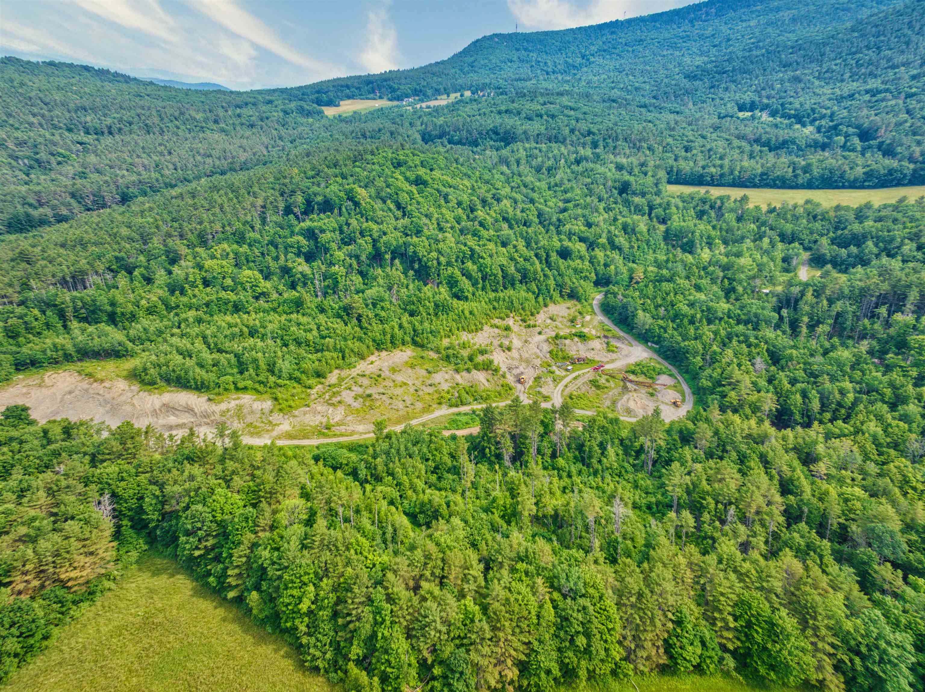
$1,620,000 | Price Per Acre $0 | Total Lots 22 | Acres 153.73 READING VT
View Details & 11 images
Description:Tucked away near the sought-after communities of Woodstock, West Windsor, and Ludlow, this untouched parcel invites endless possibilities. From its elevated perch, it offers sweeping views of Mt. Ascutney and the Connecticut River Valley in every direction. The Northern New England forested landscape is crisscrossed with trails, old roads, and natural springs, perfect for exploration. There are plenty of spots for a homesite, a family retreat, or even a simple rustic getaway to relax, recharge, and dream about the future.
-
Price Change! reduced by $600,000 down 15% on May 15th 2026
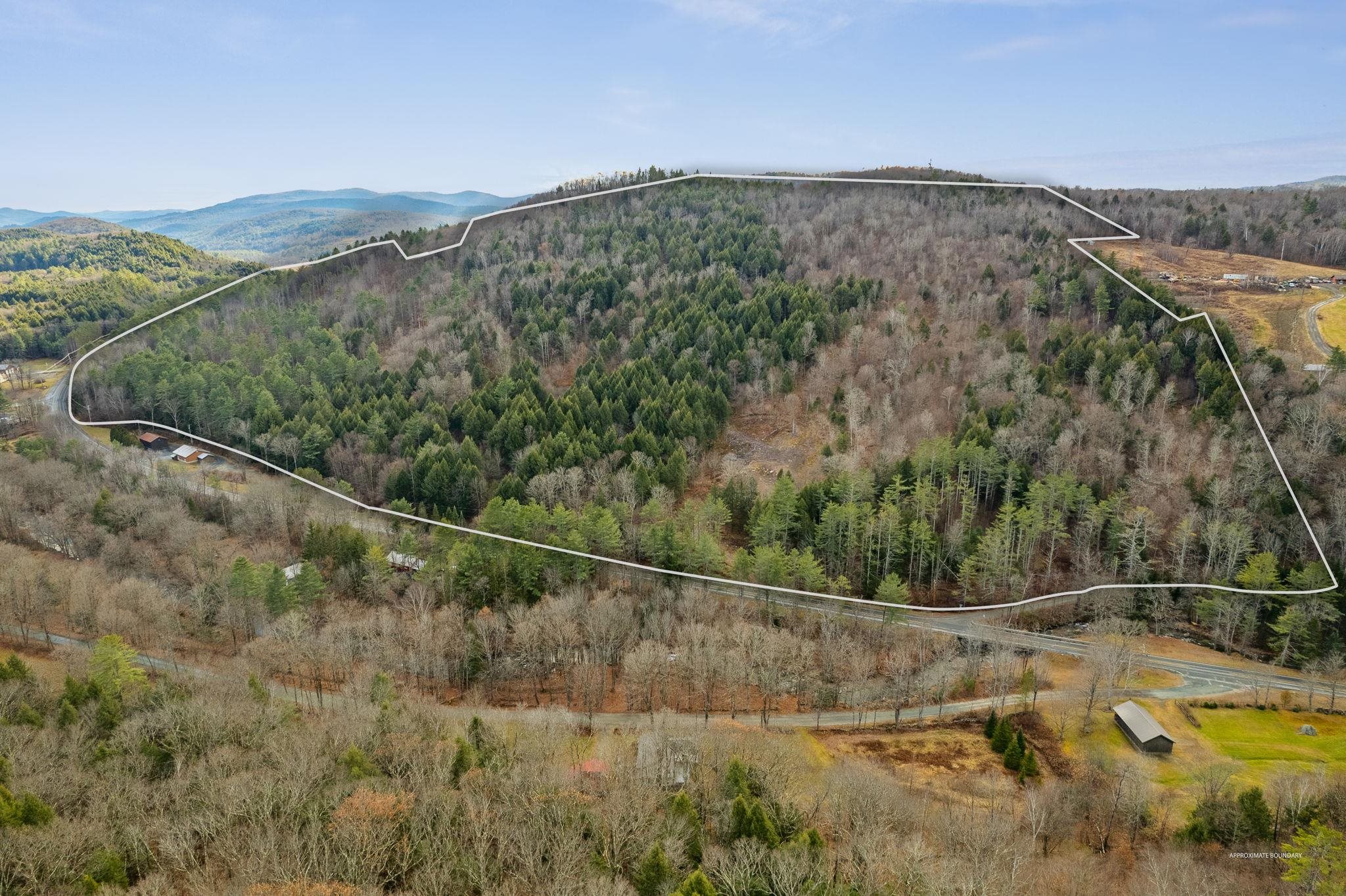
$3,900,000 | Price Per Acre $0 | Total Lots 2 | Acres 100 UNITY NH
View Details & 32 images
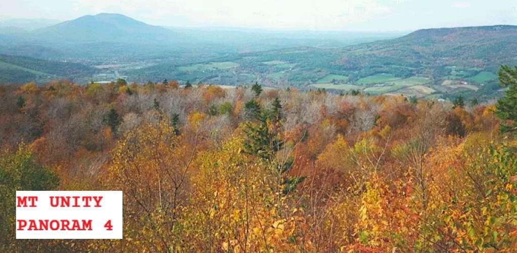
Description:Security by Obscurity: Own Mt. Unity, NH! (1,870 ft., 570 m) **NOTE: the price of this site will be reduced by $100,000 per month continuously ("Dutch Auction"). Bitcoin accepted.** Located in the Dartmouth-Sunapee Vacation Region of New Hampshire, the "Live Free or Die" state, this 100 acre site (tax lots 323 and 858) is perfect for those seeking privacy, high security/defensibility, accessibility, and exceptional 360 degree views. Land includes 94 acres in “current use”, and 6-acre buildable lot (former US Cellular transmission tower location, 126' E/W x 45' N/S) on a second high point aside from the summit of Mt. Unity, with commercial power at site; commercial grade high-capacity/high-reliability fiber optic internet on site with 10 Gbps+ data transfer. At site boundary, Mica Mine Road is Class VI; driveway to building site is 900 ft. long, ascending clockwise. The summit of Mt. Unity is appropriate for helipad; its north face cliff (35 to 45 ft., see attached elemental/geological sampling results for metals on site) provides a perfect access point for your underground lair / ‘Batcave’. Vegetative cover is northern hardwood forest, with pockets of hemlock, pine, birch, and spruce. Approx 15 minutes direct/helicopter from Lebanon airport and 30 minutes from Manchester. Ten miles to Lake Sunapee, six miles to Connecticut River and Vermont border. Borders Sullivan County Conservation Lands to the south. Lat: 43.327970, Long: -72.270980.
Copyright © 2026 PrimeMLS, Inc. All rights reserved. This information is deemed reliable, but not guaranteed.
The data relating to real estate displayed on this display comes in part from the IDX Program of PrimeMLS. The information being provided is for consumers’
personal, non-commercial use and may not be used for any purpose other than to identify prospective properties consumers may be interested in purchasing.
Data last updated June 2nd, 2026
![]()
Designed by BSC DATA